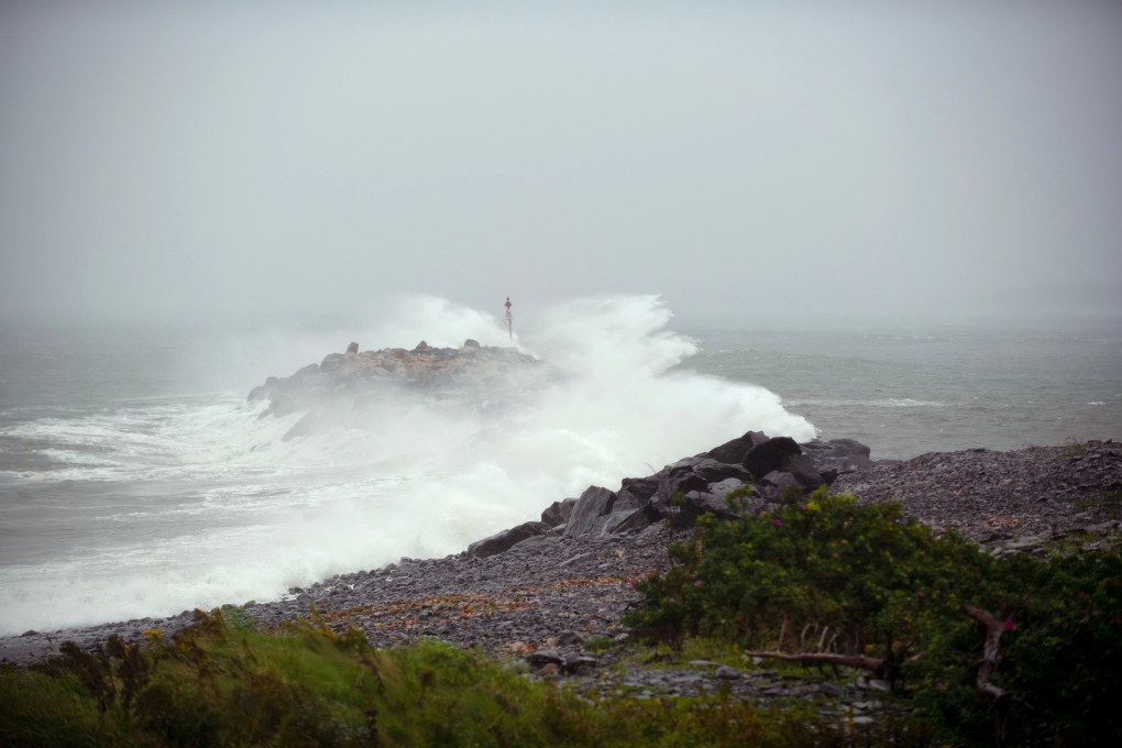
Post-tropical storm Lee has hit the Maritimes, bringing with it flooding, high waves and power outages affecting tens of thousands of homes Saturday. The centre of post-tropical storm Lee made landfall at 5 p.m. Saturday on Long Island an island in Digby County on the western coast of Nova Scotia. Areas of coastal Nova Scotia are experiencing significant storm surges, with waves crashing into roadways. Erica Fleck, Halifax Regional Municipalitys emergency management director, is asking all residents to stay indoors and keep away from the coastline. It is really unsafe for people to be out there right now, were really urging residents to please be smart and stay home and shelter in place. Theres no need to be out right now unless its an absolute emergency, Fleck said in an interview with CTV Atlantic Saturday. Fleck said that some roadways in the Lawrencetown area and the Eastern Shore have been wiped out by storm surges. The storm was downgraded from a hurricane before it hit the region. The designation refers to the structure of the storm and does not indicate lessened impacts. Water has already crossed roads
Roads that were fixed during the fires and the floods between May and July are out again in the Peggys Cove area, Fleck said. There are issues in Herring Cove, issues in Bedford, basically anywhere near water were already seeing issues, and the peak hasnt come yet, Fleck said around 12:30 p.m. Were not getting as hard a hit as we originally anticipated lots of wind here there are some trees down, but far better than we thought, said Yarmouth Mayor Pam Mood around noon Saturday. Its not beautiful here, its windy. 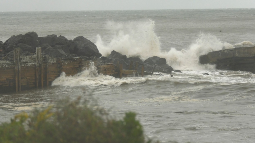
Waves crashing into a coastline in Digby, N.S., on Sept. 16, 2023, during post-tropical storm Lee. (CTV Atlantic/Sarah Plowman) As of about 6 p.m., there were more than 146,000 houses without power in Nova Scotia, about 25,600 customers in the dark in New Brunswick, and about 1,400 homes with no power on P.E.I. No outages were reported by Newfoundland Power as of 4:30 p.m. Matt Drover with Nova Scotia Power said in an interview Saturday crews are mobilized and working on restoring power in areas where winds are below 80 kilometres an hour. Weve been preparing all week for this storm, we knew that Lee was going to be a significant storm with really high winds, Drover said. Yesterday all of our crews from out of Nova Scotia arrived, we put them pretty much everywhere in the province -- recognizing that the western part of the province, the South Shore, the Valley, and also HRM would likely be hit the hardest. Environment Canada said that areas along Nova Scotias central Atlantic coast could see breaking waves of between four and six metres, and storm surge warnings were in effect from Shelburne County eastward to Guysborough County. Nova Scotia RCMP are asking drivers to stay off the roads. Police said theyve been receiving reports of drivers heading to the coast to watch the waves. This action is putting themselves at risk along with First Responders in the event of rescue attempts, said RCMP in a post on social media. In New Brunswick there are reports of flooding in some low-lying areas, including in Saint John and in Fredericton. A couple historic trees believed to be more than 100-years-old have been downed in uptown Saint John. City officials said in a statement that crews and arborists are addressing the sites on a priority basis and the public is asked to avoid driving around fallen trees and to use extreme caution in areas where crews are working. A hurricane watch is in place for Grand Manan Island and coastal Charlotte County, N.B., and for most of Nova Scotias Atlantic coast, stretching from Digby County through to Halifax County, while a tropical storm warning remains in effect for most of Nova Scotia and for New Brunswicks Bay of Fundy coast and parts of the province along the Northumberland Strait. The storm is forecast to bring more than 100 millimetres of rain in some areas, and Environment Canada is warning of possible flooding in parts of southwestern Nova Scotia and New Brunswick, including Saint John and Moncton. Wind gusts could reach 120 kilometres an hour, which may topple trees, down power lines and result in structural damage. Though Lee has transitioned from a hurricane to a strong post-tropical cyclone, our concerns about the threat it poses are unchanged, said Kyle Leavitt, New Brunswicks Emergency Measures Organization director, in a Saturday afternoon statement. In fact, Lee has arrived faster and with slightly greater intensity than expected. In P.E.I., Public Safety Minister Bloyce Thompson is asking Islanders to make final preparations for the storm that is expected to hit the province later on Saturday. We know that this will not be as strong as storms that have impacted us over the previous few years, but we need to be sensible in preparing so that we are ready in any event. I urge Islanders to please stay inside during times of high winds, stay inland and away from coastal water, Thompson said in a statement Saturday.
|